

GeoBench Forestnet#
Intro#
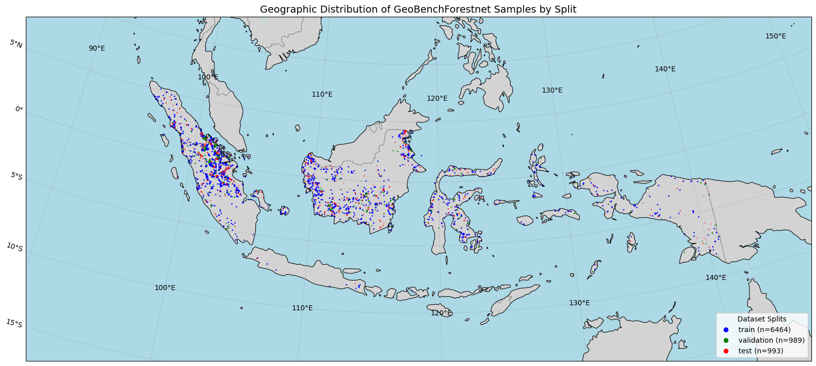
Forestnet Irvin et al. 2020 is a curated dataset of Landsat 8 satellite images of known forest loss events paired with driver annotations from expert interpreters in South Asia.
Dataset Characteristics#
Modalities:
Landsat 8 (6 spectral bands) with superimposed forest loss events polygons
Spatial Resolution:
Landsat 8: 15
Temporal Resolution: Multiple acquisitions per patch but treated as different samples
Image Dimensions: 332x332 pixels (1.2km x 1.2km patches)
Labels: Expert interpreters
Geographic Distribution: South Asia
Temporal Coverage: 2013-2017
Dataset Setup and Initialization#
[1]:
from pathlib import Path

from geobench_v2.datamodules import GeoBenchForestnetDataModule

# Setup paths
PROJECT_ROOT = Path("../../")


# Initialize datamodule
datamodule = GeoBenchForestnetDataModule(
    img_size=332,  # Original resolution
    batch_size=16,
    num_workers=4,
    root=PROJECT_ROOT / "data" / "forestnet",
    download=True,
)


datamodule.setup("fit")
datamodule.setup("test")

print("Forestnet datamodule initialized successfully!")
print(f"Training samples: {len(datamodule.train_dataset)}")
print(f"Validation samples: {len(datamodule.val_dataset)}")
print(f"Test samples: {len(datamodule.test_dataset)}")
/opt/app-root/src/fm-geospatial/pf/envs/geo-env/lib64/python3.11/site-packages/tqdm/auto.py:21: TqdmWarning: IProgress not found. Please update jupyter and ipywidgets. See https://ipywidgets.readthedocs.io/en/stable/user_install.html
  from .autonotebook import tqdm as notebook_tqdm
/opt/app-root/src/fm-geospatial/pf/envs/geo-env/lib64/python3.11/site-packages/transformers/utils/generic.py:441: FutureWarning: `torch.utils._pytree._register_pytree_node` is deprecated. Please use `torch.utils._pytree.register_pytree_node` instead.
  _torch_pytree._register_pytree_node(
Initializing normalizer from class: ZScoreNormalizer
Initializing normalizer from class: ZScoreNormalizer
Initializing normalizer from class: ZScoreNormalizer
Forestnet datamodule initialized successfully!
Training samples: 6464
Validation samples: 989
Test samples: 993
Geographic Distribution Visualization#
[2]:
geo_fig = datamodule.visualize_geospatial_distribution()
Sample Data Visualization#
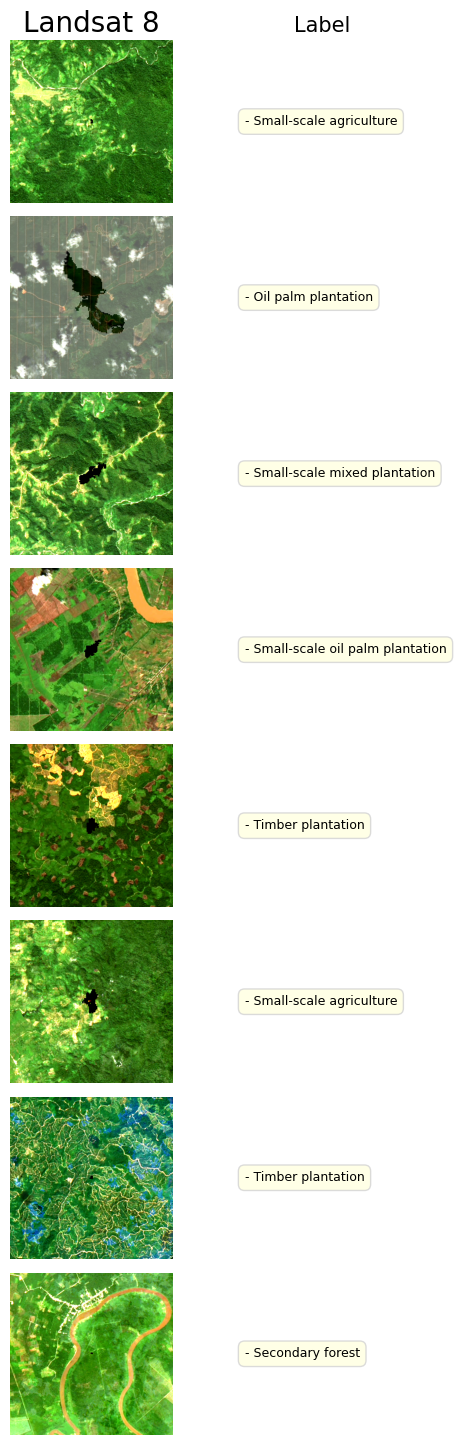
The sample includes Landsat 8, with some overimposed polygons of known forest loss events.
[3]:
fig, batch = datamodule.visualize_batch()
GeoBenchV2 Processing Pipeline#
Preprocessing Steps#
Split Generation:
Used existing train/validation/test splits from GEO-Bench v1
References#
Irvin J, Sheng H, Ramachandran N, Johnson-Yu S, Zhou S, Story K, Rustowicz R, Elsworth C, Austin K, Ng AY. Forestnet: Classifying drivers of deforestation in indonesia using deep learning on satellite imagery. arXiv preprint arXiv:2011.05479. 2020 Nov 11
Lacoste A, Lehmann N, Rodriguez P, Sherwin E, Kerner H, Lütjens B, Irvin J, Dao D, Alemohammad H, Drouin A, Gunturkun M. Geo-bench: Toward foundation models for earth monitoring. Advances in Neural Information Processing Systems. 2023 Dec 15;36:51080-93.
[ ]: